Madrid, Spain — Deputy Speaker and Lone District of Antique Representative Loren Legarda promoted the development and deployment of Filipino-designed and assembled satellites into space and emphasized the value of utilizing space science and technologies in enhancing the country and the world’s resilience to disasters and climate change.
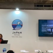
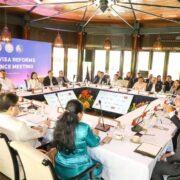
Legarda made the statement in her keynote address at the “Ocean and Climate—Contribution of the Space Technology,” organized by the Ocean Policy Research Institute of the Sasakawa Peace Foundation (OPRI-SPF) and the Japan Aerospace Exploration Agency (JAXA), held at the sidelines of the 25th Session of the Conference of Parties (COP25) to the United Nations Framework Convention on Climate Change (UNFCCC) in Madrid, Spain.
Legarda, who is recognized as a Global Leader for Tomorrow by the World Economic Forum and a UNEP Laureate and is currently UNISDR Global Champion for Resilience, UNFCCC National Adaptation Plan Champion, and Member to the Governing Board of the Green Climate Fund, is Head of the Philippine Delegation to COP25 from December 6 to 12, 2019.
“We see the value of harnessing space science and technology, and its application in improving localized data needed for climate and disaster risk management,” Legarda said, adding that, “With our very own satellites, we are now able to capture satellite data and target a particular location in our country, allowing us further to understand our vulnerabilities as a nation, especially in light of the intensifying effects of climate change.”
In 2016, the Philippines made history with the country’s very first Filipino microsatellite, called Diwata-1, being launched into space. In 2018, another microsatellite, called Diwata-2, and a nanosatellite, called Maya-1, was also deployed into space.
Legarda mentioned that Diwata-1 is built to undertake scientific earth observation missions related to weather observation, environmental monitoring, and disaster risk management, while Diwata-2 also captures satellite images to support the determination of extent of damages from disasters, monitoring of changes in vegetation, monitoring of natural and cultural heritage sites, and observation of cloud patterns and weather disturbances. She added that Maya-1 functions as a low-cost observation satellite, but is also able to capture images and collect sensor data in various remote areas.
She also noted that the development of these satellites was made possible through the Philippine Scientific Earth Observation Microsatellite Program (PHL-MICROSAT), which is a collaboration among the Department of Science and Technology (DOST), the University of the Philippines, and partners from the Hokkaido and Tohoku Universities, with the Philippine Council for Industry, Energy and Emerging Technology Research and Development (DOST-PCIEERD) as the monitoring agency. Maya-1 was further developed under the Kyushu Institute of Technology’s (Kyutech) 2nd Joint Global Multination Birds Project (Birds-2), which assists non-space-faring countries in building their own miniature satellites.
Furthermore, she also highlighted that, with the enactment of the Philippine Space Act, a law she co-authored in the Senate, which mandates the creation the Philippine Space Agency and establishment of the Philippine Space Development and Utilization Policy, we are showing our commitment to enhance our natural hazard and risk assessment to inform our climate change adaptation and resilient investment planning.
“Our Diwatas and Maya in space provided the impetus for the enactment of the Philippine Space Act this year to ensure the continuous development of space science and technology in the country. With this commitment, not only will our country be a responsible global space actor, but also be one of the contributors in the region in using space technology for adaptation and disaster risk reduction,” Legarda highlighted.
However, Rep. Legarda noted that the Philippine Space Agency is still in its infancy stage and would require support from established space agencies and institutions in order to support country initiatives that harness and utilize space science and technologies.
She further mentioned the Satellite-Based Monitoring and Assessment of Rehabilitation in Typhoon Affected Regions (SMARTER-VISAYAS) Initiative, a rapid damage assessment that acquired high-resolution multispectral satellite imagery through dedicated tasking services (DTS) months after the devastation of Typhoon Haiyan in 2013; and the Geospatial Information Management and Analysis Project for Hazards and Risk Assessment (GeoRiskPH), which aims to be the country’s central source of information for accurate and efficient hazards and risk assessment by providing protocols and platforms to share hazards, exposure, and risk information to authorities and citizens.
“As we look for innovative solutions, we must utilize the most recent advances in the use of space applications and information. We must strengthen international cooperation in this area, helping ensure that we bring the benefits of space technology to our most climate-vulnerable communities,” Legarda added.
“For a developing country, venturing into space science may be considered by some as the least of our priorities. It is not yet well ingrained in our educational system for our younger children to even begin to understand that this is not science fiction. But we want to change this. We want our youth to also dream and aspire to be space scientists someday,” Legarda concluded.


