Nine of 16 Filipino engineers, who recently completed the satellite technology development training in the United Kingdom, presented on Thursday, September 16, the preliminary design of the Multispectral Unit for Land Assessment (MULA).
MULA, an observation satellite, aims to capture images of the earth from outer space.
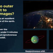
“Space gives us an excellent bird’s-eye view of the earth. MULA can cover the Philippines in under 5 minutes at a 600-km sun-synchronous (nearly polar) orbit,” said Engr. John Leur Labrador, MULA project manager.
MULA will pass by the Philippines at 10:30 a.m. every day “when cloud cover is least apparent, and the sunlight is high to see a lot of details in the ground,” Labrador said.
Much like a gaming laptop, MULA can consume 150 watts when fully operational. It has solar-powered batteries, expected to last in space for at least five years.
“When MULA is capturing images [and] sending down data via the radio link, it is consuming 150 watts of power,” he said.
The preliminary satellite design “is a critical phase in satellite development, especially with MULA being the biggest the Philippines is building so far,” said Dr. Maricor N. Soriano, program leader of Space Technology Applications Mastery, Innovation and Advancement (STAMINA4Space).
Soriano said MULA would help researchers capture earth images for different environmental applications such as disaster management, land use, land cover change mapping, crop monitoring, and forestry management.
“The Philippine MULA is a fitting finale that allows the transition of satellite development from an academic research setting to an operational field endeavor,” she said.
MULA is expected to launch in 2023, Soriano said.
–
Stay updated with news and information from the Department of Science and Technology by visiting their website at dost.gov.ph.


